Closing in
0
...
Menu
Search
LATEST
POPULAR
AIRCRAFT FOR SALE
SECTIONS
Business Aviation
Aerospace & Defense
Rotorcraft
General Aviation
FutureFlight
SUSTAINABILITY & ENVIRONMENT
CHANNELS
Aircraft
Maintenance
Avionics
Charter & Fractional
Safety
All Categories
News Archive
Newsletter Archive
MORE
Print Archives
Expert Opinion
In-Depth Reports
Videos
Webinars
Airshows & Conventions
Aviation Events
Compliance Countdown
Whitepapers
ABOUT
About AIN
Our Writers
History
Advertise
Contact Us
Subscribe
LATEST
POPULAR
AIRCRAFT FOR SALE
SECTIONS
ABOUT
Search
Subscribe
Search
Avionics
Mlat: Aviation’s Swiss army knife
For many, multilateration (sometimes abbreviated Mlat) is one of those vague ATC terms that is always hard to define.
Share
Post
Share
Print
Copy
Email
By
John Sheridan
January 27, 2010
More In Avionics
Klatt Works O2 Mask Head-Up Display Lets Pilot See in Smoky Cockpits
Pilots might be able to breathe during a smoke emergency, but landing is a problem if pilots can't see their instruments.
Avionics
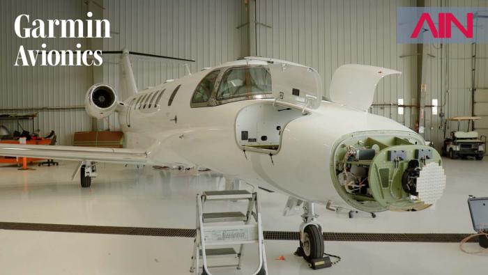
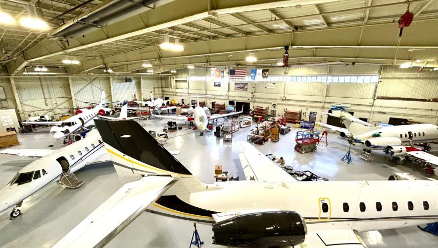
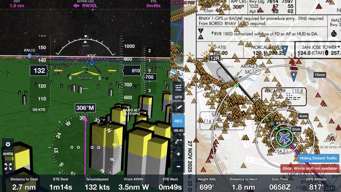
We Visit Garmin’s Hangars and Get an FAA Data Comm Demo in the Air
See how Garmin develops avionics packages, and how new technology can benefit older aircraft.
Avionics
Elliott Offers G5000 Install Incentive on Citation XLS+
Limited-time $75,000 incentive available for first five qualifying aircraft
Avionics
ForeFlight Cuts CFI Discount, Adds Referral Program
Up to 100% off is available to instructors when their students sign up
Avionics
Garmin Adds Graphical Notams Overlay on SmartCharts
Features depicts closed runways, taxiways, and ramps with color-coding
Avionics
RTX’s Raytheon Expands the Air Defense Shield
Threats ranging from ballistic missiles to drones proliferate in the Gulf theater, requiring increased numbers of high-performance radars and effectors
Avionics
Black Box in the Sky Captures Data on the Fly
Honeywell also seeks solutions for GPS jamming, pilot fatigue, and more
Avionics
Boeing Sells Digital Aviation Solutions to Thoma Bravo
New company led by Brad Surak is named Jeppesen ForeFlight
Avionics